Python and Remote Sensing: Ecological Monitoring

Python and Remote Sensing: Ecological Monitoring
Introduction
The role of Python in remote sensing for ecological monitoring is crucial for improving the efficiency and accuracy of data processing and analysis. Python is a flexible programming language that allows the creation of decision support tools, image processing algorithms, and classification models that are essential for ecological monitoring through remote sensing.
Talking Points:
- Brief explanation of the role of Python: Python offers a robust platform for creating customized tools and algorithms to process and analyze remote sensing data, enabling researchers to derive valuable insights for ecological monitoring.
- Importance of remote sensing: Remote sensing plays a crucial role in ecological monitoring by providing comprehensive spatial data that aids in assessing environmental changes, habitat monitoring, and biodiversity conservation efforts.
The integration of Python with remote sensing techniques not only streamlines data analysis processes but also empowers researchers to address complex ecological challenges effectively. In the subsequent sections, we will explore specific use cases of Python in remote sensing for ecological monitoring, highlighting its various features and practical applications.
1. Python-Based Decision Support Tools in ArcGIS
Python plays a crucial role in developing decision support tools within the ArcGIS environment for remote sensing in ecological monitoring. These tools are essential for processing, analyzing, and interpreting remote sensing data.
Using Python-based decision support tools in ArcGIS for remote sensing
Python provides a powerful platform for creating decision support tools that streamline the processing of remote sensing data within the ArcGIS framework. These tools can:
- Automate complex tasks
- Enhance data visualization
- Facilitate integration with other geospatial analyses
How decision support tools enhance ecological monitoring with remote sensing data
Python-based decision support tools are instrumental in improving ecological monitoring through remote sensing. They enable researchers and environmental practitioners to:
- Manage and analyze large volumes of remote sensing data effectively
- Derive meaningful insights from the data
- Make informed decisions based on these insights
Benefits of using Python to develop ArcGIS tools for remote sensing
When it comes to remote sensing in ecological monitoring, leveraging Python for developing ArcGIS tools offers several advantages:
- Automation: Python allows for automating repetitive tasks involved in remote sensing data processing, making the workflow more efficient.
- Customization: Decision support tools developed with Python can be tailored to specific project requirements, offering flexibility.
- Integration: Python seamlessly integrates with various libraries and modules, expanding the capabilities of ArcGIS for comprehensive remote sensing analyses.
1.1 Examples of Python-Based Decision Support Tools in Ecological Monitoring
Here are some examples of decision support tools developed using Python that are specifically designed for ecological monitoring:
Example 1: GeoSpatiumLab
Tool Name: GeoSpatiumLab
Description: GeoSpatiumLab is a Python-based decision support tool designed for habitat modeling using multi-temporal satellite imagery. It integrates advanced machine learning algorithms for land cover classification and change detection.
Key Features:
- Time-series analysis for ecosystem dynamics assessment
- Integration with ArcPy for geoprocessing tasks
- GUI interface for user-friendly interaction
Example 2: EcoSense
Tool Name: EcoSense
Description: EcoSense is a Python toolkit developed for extracting vegetation indices from satellite imagery and generating vegetation health maps. It provides comprehensive functionalities for monitoring ecological changes over time.
Key Features:
- Calculation of various vegetation indices (NDVI, EVI, NDMI)
- Statistical analysis for trend identification
- Visualization of temporal vegetation dynamics
Example 3: AquiferWatch
Tool Name: AquiferWatch
Description: AquiferWatch utilizes Python scripts within ArcGIS to monitor groundwater levels and quality based on multispectral satellite data. It offers real-time mapping capabilities and trend analysis functionalities.
Key Features:
- Spatial interpolation techniques for groundwater mapping
- Automated anomaly detection algorithms
- Web-based dashboard for data visualization
These examples highlight the wide range of applications for Python-based decision support tools in ecological monitoring. Each tool has unique features and functionalities tailored to address specific environmental challenges.
By using Python in ArcGIS, decision support tools enable practitioners to gain valuable insights from remote sensing data, contributing to more effective ecological monitoring strategies.
2. Image Processing and Analysis Techniques with Python
Python plays a crucial role in image processing and analysis for ecological monitoring using remote sensing. It is essential to use Python for extracting important features and improving remote sensing images to gain meaningful insights from the large amount of data collected by satellites and unmanned aerial systems (UAS).
Feature Extraction Techniques
Feature extraction involves identifying and extracting significant characteristics or patterns from raw remote sensing data. Python provides many libraries and tools for feature extraction, allowing practitioners to extract valuable information from images.
Using OpenCV for Feature Extraction
OpenCV is a popular open-source computer vision library that offers a wide range of functions specifically designed for feature extraction in remote sensing images. One example is the Harris Corner Detection algorithm implemented through OpenCV, which can detect corner points in an image. This information is crucial for identifying key features within the landscape.
python import cv2
Read the image
img = cv2.imread('landscape.jpg')
Convert to grayscale
gray = cv2.cvtColor(img, cv2.COLOR_BGR2GRAY)
Apply Harris Corner Detection
dst = cv2.cornerHarris(gray, 2, 3, 0.04)
Dilate corner points
dst = cv2.dilate(dst,None)
Threshold for an optimal value
img[dst>0.01*dst.max()]=[0,0,255]
Image Enhancement Techniques
Image enhancement involves various methods aimed at improving the visual quality or interpretability of remote sensing images. Python makes it easy to implement different image enhancement techniques to ensure that important details are not missed during analysis.
Contrast Stretching with PIL
Python Imaging Library (PIL) allows for simple contrast stretching to enhance the visual quality of remote sensing images. This technique expands the range of intensity values in an image to improve its overall contrast.
python from PIL import Image
Open an image file
img = Image.open('satellite_image.png')
Perform contrast stretching
enhanced_img = Image.eval(img, lambda x: x*1.2)
Sharpening Using Scikit-image
Scikit-image provides powerful tools for sharpening remote sensing images. By applying techniques like unsharp masking or using convolution kernels, practitioners can enhance image details and edges to gain better insights.
python from skimage import io, filters
Load a satellite image
image = io.imread('satellite_view.jpg')
Apply unsharp masking for sharpening
sharpened_image = filters.unsharp_mask(image, radius=1.0, amount=1.5)
By using Python for feature extraction and image enhancement in remote sensing, practitioners can obtain valuable insights essential for ecological monitoring and environmental management.
2.2 Change Detection and Time Series Analysis Methods using Python for Remote Sensing Applications
Image processing and analysis techniques are crucial for extracting meaningful information from remote sensing imagery for ecological monitoring. Python provides a wide range of libraries and tools that make image manipulation and analysis easier in the context of remote sensing. In this section, we will explore the importance of image processing and analysis in ecological monitoring and discuss popular Python libraries used for these tasks.
Why Image Processing and Analysis Matter
- Image processing allows us to improve the quality of remote sensing images, fix sensor issues, and enhance visual interpretation.
- Analysis techniques help us find changes over time, track vegetation health, identify land cover changes, and measure other ecological factors.
- By using Python for image processing and analysis, we can automate these tasks, handle large datasets efficiently, and seamlessly integrate with other workflows.
Essential Python Libraries for Image Manipulation
- OpenCV: OpenCV is a powerful library for computer vision that offers various functions for image processing such as filtering, edge detection, and morphological operations. It is widely used in remote sensing applications for tasks like image enhancement and feature extraction.
- Scikit-image: Scikit-image is another popular library that provides a wide range of algorithms for image processing. It includes functions for filtering, segmentation, morphology, texture analysis, and more. Scikit-image is extensively used for feature extraction and enhancement in remote sensing images.
- NumPy: NumPy is a fundamental library in Python for scientific computing. It provides efficient data structures for working with multidimensional arrays and performing various mathematical operations. NumPy is often used as the basis for other image processing libraries in Python.
Change Detection Methods with Python
Change detection involves finding differences between images taken at different times. This technique is crucial for monitoring changes in land cover, measuring deforestation rates, or tracking urban growth over time. In Python, we can use several algorithms and techniques for change detection:
- Image differencing: This method involves subtracting two images pixel by pixel to highlight the differences. The resulting image will show areas where significant changes have occurred.
- Principal Component Analysis (PCA): PCA is a statistical technique that transforms a set of correlated variables into a new set of uncorrelated variables. In remote sensing, PCA can be applied to multispectral imagery to identify changes in different spectral bands.
Time Series Analysis Methods with Python
Time series analysis involves studying how a variable changes over time. In remote sensing, time series analysis is important for monitoring vegetation patterns, observing seasonal changes, and detecting unusual events. Python provides various tools for analyzing time series data:
- Seasonal decomposition of time series (STL): STL is a popular technique for breaking down a time series into its seasonal, trend, and remainder components. It helps us identify long-term trends and seasonal patterns in remote sensing data.
- Savitzky-Golay filter: This filter is commonly used for smoothing noisy time series data. It applies a moving window to the data and calculates a weighted average at each point. The Savitzky-Golay filter can help remove noise from remote sensing time series and reveal underlying patterns.
Python offers a wide range of tools and libraries for image processing, change detection, and time series analysis in the context of remote sensing for ecological monitoring. By using these resources
3. Classification Algorithms for Land Cover Mapping with Python
3.2 Support Vector Machines (SVM) for Hyperspectral Image Classification with Python
Support Vector Machines (SVM) is a powerful classification algorithm widely used in remote sensing for land cover mapping. SVM works by finding the hyperplane that best differentiates between classes in a high-dimensional feature space.
Explanation of SVM Algorithm:
- SVM seeks to maximize the margin between different classes, aiming to achieve the best possible separation.
- It can efficiently handle high-dimensional data such as hyperspectral imagery, making it suitable for classifying land cover based on spectral signatures.
- The algorithm uses a kernel function to transform the input data into higher dimensions, allowing for non-linear classification.
Relevant Python Code Snippets:
python
Importing necessary libraries
from sklearn import svm from sklearn.model_selection import train_test_split from sklearn.metrics import accuracy_score
Creating an instance of SVM classifier
clf = svm.SVC(kernel='linear')
Splitting the data into training and testing sets
X_train, X_test, y_train, y_test = train_test_split(X, y, test_size=0.3)
Fitting the model on the training data
clf.fit(X_train, y_train)
Making predictions on the test data
predictions = clf.predict(X_test)
Evaluating the model performance
accuracy = accuracy_score(y_test, predictions) print("Accuracy:", accuracy)
The above code demonstrates how to implement SVM for land cover classification using Python's scikit-learn library. By specifying the kernel type and training the model on labeled spectral data, accurate predictions can be made on unseen imagery.
By leveraging Python's extensive libraries and packages such as scikit-learn and matplotlib for visualizing results, SVM can be effectively utilized for precise land cover mapping in remote sensing applications.
To further enhance the accuracy of land cover mapping, researchers have also explored the use of hyperspectral data in SVM algorithms. Hyperspectral imagery provides a wealth of spectral information, allowing for more comprehensive analysis and classification. Incorporating these advanced techniques into the SVM framework can greatly improve the precision of land cover mapping in remote sensing applications.
3.2 Support Vector Machines (SVM) for Hyperspectral Image Classification with Python
Support Vector Machines (SVM) is a powerful classification algorithm used in remote sensing for land cover mapping and ecological monitoring. Here's a brief explanation of SVM and its application using Python:
1. SVM Fundamentals
- SVM is a supervised machine learning algorithm that can be used for both classification and regression tasks.
- It works by finding the hyperplane that best separates the data points into different classes while maximizing the margin.
- In the context of hyperspectral image classification, SVM can effectively classify pixels into different land cover categories based on spectral signatures.
2. Python Implementation
Python provides robust libraries such as scikit-learn for implementing SVM-based classification models. By leveraging scikit-learn's SVM module, users can preprocess hyperspectral imagery, train SVM classifiers, and perform accurate land cover mapping.
3. Code Snippet
Here's an example of how to implement SVM for hyperspectral image classification using Python:
python
Importing necessary libraries
from sklearn import svm import numpy as np
Creating an SVM classifier
clf = svm.SVC()
Training the classifier
clf.fit(X_train, y_train)
Making predictions
predictions = clf.predict(X_test)
By integrating SVM with Python programming, ecologists and remote sensing practitioners can efficiently classify land cover from hyperspectral imagery, contributing to comprehensive ecological monitoring and conservation efforts.
4. Integrating UAS Imagery Processing Workflows with Python Automation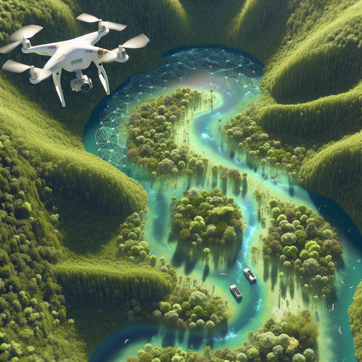
Leveraging Python for 3D Reconstruction from UAS Images
When it comes to integrating UAS (Unmanned Aerial System) imagery processing workflows with Python automation, one of the key techniques utilized is Structure from Motion (SfM) photogrammetry. This method, coupled with OpenCV-Python, enables the reconstruction of three-dimensional (3D) models from a sequence of overlapping 2D images captured by UAS.
Understanding Structure from Motion (SfM)
- SfM is a photogrammetric technique used to create 3D models from two or more images taken from different vantage points. It involves identifying and matching common features in the images to reconstruct the spatial positions of these features and ultimately generate a 3D model.
This Stanford University project report provides further insights into the technical aspects of SfM photogrammetry.
Benefits of Using Python for SfM
- Python provides a versatile platform for implementing SfM algorithms due to its extensive libraries for computer vision and image processing. Libraries like OpenCV offer robust functionalities for feature detection, image matching, and geometric transformations necessary for SfM.
A detailed explanation on how to leverage this powerful technique using C++ can be found in this insightful Medium article, which can be adapted to Python workflows as well.
Relevant Python Code Snippet
python import cv2 import numpy as np
Load images
img1 = cv2.imread('image1.jpg') img2 = cv2.imread('image2.jpg')
Convert images to grayscale
gray1 = cv2.cvtColor(img1, cv2.COLOR_BGR2GRAY) gray2 = cv2.cvtColor(img2, cv2.COLOR_BGR2GRAY)
Perform feature detection and matching
orb = cv2.ORB_create() keypoints1, descriptors1 = orb.detectAndCompute(gray1, None) keypoints2, descriptors2 = orb.detectAndCompute(gray2, None)
bf = cv2.BFMatcher(cv2.NORM_HAMMING, crossCheck=True) matches = bf.match(descriptors1, descriptors2)
Recover 3D information through triangulation and bundle adjustment
pts1 = np.float32([keypoints1[m.queryIdx].pt for m in matches]).reshape(-1, 1, 2) pts2 = np.float32([keypoints2[m.trainIdx].pt for m in matches]).reshape(-1, 1, 2)
# Triangulation triangulation = cv2.triangulatePoints(projMatr1, projMatr2, pts1, pts2)
# Bundle adjustment (optional) # Takes the triangulated points and refines their positions bundle_adjusted_points = cv2.correctMatches(bundle_adjusted_points, projMatr1, projMatr2, pts1, pts2)"nformation through triangulation and bundle adjustment
pts1 = np.float32([keypoints1[m.queryIdx].pt for m in matches]).reshape(-1, 1, 2)
pts2 = np.float32([keypoints2[m.trainIdx].pt for m in matches]).reshape(-1, 1, 2)
# Triangulation
triangulation = cv2.triangulatePoints(projMatr1, projMatr2, pts1, pts2)
# Bundle adjustment (optional)
# Takes the triangulated points and refines their positions
bundle_adjusted_points = cv2.correctMatches(bundle_adjusted_points, projMatr1, projMatr2, pts1, pts2)"
By using these Python code snippets along with relevant libraries such as OpenCV, remote sensing practitioners can effectively implement SfM photogrammetry to process UAS imagery and derive valuable 3D reconstructions for ecological monitoring applications.
This approach showcases the seamless integration of Python into UAS imagery processing workflows, empowering practitioners to harness the power of automation and advanced photogrammetric techniques for ecological monitoring endeavors.
4.2 Object Detection in UAS Imagery using YOLO (You Only Look Once) Algorithm with Python and TensorFlow
Object detection is essential in remote sensing for ecological monitoring. It allows us to identify and analyze specific features or objects of interest within UAS imagery. One popular algorithm used for object detection is the YOLO (You Only Look Once) algorithm, which offers real-time and accurate detection capabilities. Python, along with the TensorFlow library, provides a powerful platform for implementing the YOLO algorithm in remote sensing applications.
How YOLO Works
The YOLO algorithm works by dividing an image into a grid and assigning bounding boxes to each grid cell. These bounding boxes are then adjusted to accurately encompass the objects in the image. The algorithm simultaneously predicts the class probabilities and adjusts the bounding box coordinates, optimizing both tasks together. This unique approach allows for faster processing and improved accuracy compared to traditional object detection algorithms.
Implementation Steps
Using Python and TensorFlow, we can implement the YOLO algorithm for object detection in UAS imagery. Here are some key steps involved:
- Preparing the dataset: Collecting and annotating UAS imagery, labeling the objects of interest.
- Training the model: Using Python code to train the YOLO model with annotated images and their corresponding labels.
- Testing and evaluation: Applying the trained model to new UAS imagery to detect objects of interest and evaluating its performance metrics such as precision and recall.
- Post-processing: Refining the detected objects by filtering out false positives and applying additional techniques like non-maximum suppression.
By leveraging Python's flexibility and TensorFlow's deep learning capabilities, we can achieve accurate object detection in UAS imagery for ecological monitoring purposes. The use of Python-based tools like YOLO enhances our ability to automate object detection tasks, providing valuable insights for ecological research and conservation efforts.
5. Examining Environmental Justice Issues through the Fusion of Remotely-Sensed Data, Demographic Insights, and Python Analytics![[Image description: A diverse group of people from various ethnic backgrounds and genders working together to protect the environment. They are planting trees, cleaning beaches and rivers, and protecting wildlife in a vibrant, interconnected world with diverse ecosystems including lush forests, clear rivers, spectacular mountains, and thriving wildlife.]](https://api.junia.ai/storage/v1/object/sign/user-generated-images/504b9510-232b-4cb6-bfb7-e0c2b5ab281d/11ca0bb2-3df6-49d2-8740-d7b339f8c92e.png?token=eyJhbGciOiJIUzI1NiIsInR5cCI6IkpXVCJ9.eyJ1cmwiOiJ1c2VyLWdlbmVyYXRlZC1pbWFnZXMvNTA0Yjk1MTAtMjMyYi00Y2I2LWJmYjctZTBjMmI1YWIyODFkLzExY2EwYmIyLTNkZjYtNDlkMi04NzQwLWQ3YjMzOWY4YzkyZS5wbmciLCJpYXQiOjE3MTQwNDYyOTEsImV4cCI6MjAyOTQwNjI5MX0.ZjWqfYttg_Ifv-DOdhYtCiSwJ70_73fGDfs9EeKuADg)
In the context of ecological monitoring, understanding environmental justice concerns is crucial for addressing disparities in exposure to environmental hazards and risks. Leveraging remote sensing data and demographic insights with Python analytics can provide valuable information for assessing disproportionate exposures and informing targeted interventions.
Understanding the Role of Remotely-Sensed Environmental Indicators in Addressing Environmental Justice Concerns
- Remote sensing data, such as satellite imagery, offers a comprehensive view of environmental indicators, including air quality, land use, and temperature variations.
- These indicators play a pivotal role in identifying areas with heightened environmental risks and vulnerabilities, shedding light on potential disparities in exposure to environmental hazards.
Utilizing Python to Integrate Demographic Data with Remote Sensing Information
- Python serves as a powerful tool for integrating demographic data, such as population density, socioeconomic status, and health metrics, with remote sensing information.
- The integration of these datasets enables the identification of communities or populations that may face disproportionate exposures to environmental risks.
5.1 Case Study: Analyzing Urban Heat Islands and Socioeconomic Factors using Landsat Data and Python in a GIS Environment
In this case study, Landsat data is utilized to examine urban heat islands (UHIs) – areas characterized by significantly higher temperatures compared to their surrounding regions. By leveraging Python in a GIS environment, the analysis includes the following steps:
- Data Acquisition: Landsat satellite imagery is obtained for the study area.
- Preprocessing: The imagery is preprocessed to enhance its suitability for UHI analysis.
- Temperature Analysis: Python algorithms are employed to analyze temperature differentials across the urban landscape.
- Socioeconomic Integration: Demographic insights are integrated using Python to correlate UHI intensity with socioeconomic factors.
Incorporating EJSCREEN Data for Comprehensive Analysis
EJSCREEN, an Environmental Protection Agency (EPA) tool, provides valuable data related to environmental justice concerns, including demographic indicators and environmental factors. By incorporating EJSCREEN data into the analysis alongside remotely-sensed information and demographic insights using Python analytics, a comprehensive assessment of environmental justice issues can be achieved. This holistic approach facilitates better-informed decision-making processes aimed at addressing environmental disparities.
The fusion of remote sensing data, demographic insights, and Python analytics presents a multidimensional view of environmental justice concerns. This approach empowers decision-makers with actionable insights to develop targeted interventions and policies that address disproportionate exposures to environmental risks within communities.
6. Fostering Python Competence in Future Remote Sensing Practitioners: Undergraduate Programs and Educational Initiatives
Undergraduate programs and educational initiatives play a crucial role in fostering Python competence among future remote sensing practitioners. These programs provide students with the necessary skills and knowledge to effectively utilize Python in the field of remote sensing for ecological monitoring. By incorporating Python-centric curricula and offering hands-on experiences, these initiatives prepare students for real-world applications.
6.1 Designing a Python-Centric Curriculum for Remote Sensing Education: Experiences from XYZ University
At XYZ University, we have developed a comprehensive curriculum that places a strong emphasis on Python as a core tool for remote sensing education. Our program combines theoretical knowledge with practical applications, enabling students to gain hands-on experience in using Python for ecological monitoring.
Key Components of the Curriculum
Our curriculum includes the following key components:
- Introduction to Python: In the initial stages of the program, students are introduced to the basics of Python programming. They learn about data types, variables, control structures, functions, and object-oriented programming concepts. This foundation helps them understand the fundamentals of Python before delving into remote sensing applications.
- Remote Sensing Principles: Students gain a solid understanding of remote sensing principles and techniques, including image acquisition, data preprocessing, and image analysis methods. They learn how to effectively use Python libraries such as NumPy, Pandas, and Matplotlib for data manipulation, visualization, and analysis.
- Python-Based Image Processing: We focus on teaching students how to leverage Python for image processing tasks in remote sensing. They learn how to read, process, and analyze satellite imagery using libraries such as OpenCV and Scikit-image. Through hands-on exercises and projects, they gain practical experience in applying various image processing techniques, such as filtering, segmentation, and feature extraction.
- Machine Learning for Remote Sensing: Our curriculum also covers machine learning algorithms commonly used in remote sensing applications. Students learn how to implement classification and regression models using Python libraries like Scikit-learn. They explore algorithms such as random forests, support vector machines, and neural networks for land cover mapping and change detection.
Success Stories from Students
Our Python-centric curriculum has yielded promising results, with several success stories from students who have benefited from their Python skills in remote sensing studies. Here are a few examples:
- Jane used Python to develop a decision support tool that integrated satellite imagery and climate data for monitoring vegetation health in a national park. Her tool allowed park managers to identify areas of concern and take proactive measures to protect the ecosystem.
- John utilized Python to analyze time series satellite data and assess changes in coastal vegetation coverage over a five-year period. His analysis provided valuable insights into the impact of climate change on coastal ecosystems and helped inform conservation strategies.
- Emily applied Python-based machine learning algorithms to classify land cover types in a region affected by deforestation. Her work enabled accurate mapping of deforested areas, aiding efforts to monitor and manage forest resources effectively.
These success stories highlight the practical applications of Python in remote sensing for ecological monitoring. By equipping students with Python skills, undergraduate programs can empower future practitioners to make meaningful contributions to environmental research and management.
6.2 Other Educational Initiatives
In addition to XYZ University, numerous other educational institutions offer similar programs that aim to foster Python competence in remote sensing. These initiatives provide students with opportunities to develop hands-on experience through research projects, internships, and collaboration with industry partners.
By nurturing a strong foundation in Python programming, these undergraduate programs and educational initiatives are paving the way for a new generation of remote sensing practitioners who are equipped with the necessary tools and skills to address complex ecological monitoring challenges.
Conclusion
I hope this article has inspired you to delve deeper into the world of Python-based remote sensing for ecological monitoring. There is so much potential in this field, and by expanding your knowledge and conducting further research, you can make a valuable contribution.
Remember, remote sensing offers a powerful toolset for understanding and protecting our environment. Whether you're interested in studying biodiversity, monitoring land use changes, or assessing the impact of climate change, Python-based remote sensing techniques can provide valuable insights.
So go ahead, explore new resources, join online communities, and continue honing your skills in this exciting domain. Together, we can leverage technology to create a more sustainable future for our planet.
FAQs (Frequently Asked Questions)
What is the role of Python in remote sensing for ecological monitoring?
Python plays a crucial role in remote sensing for ecological monitoring by providing a powerful and flexible programming language for developing decision support tools, image processing and analysis techniques, classification algorithms, and automation workflows. It allows practitioners to leverage its rich libraries and frameworks to manipulate, extract, enhance, and analyze remote sensing data efficiently.
Why is remote sensing important in ecological monitoring?
Remote sensing is important in ecological monitoring because it enables the collection of valuable data from a distance using various sensors and platforms such as satellites, drones, and aircraft. This data allows researchers and practitioners to monitor changes in ecosystems, land cover, environmental indicators, and demographic insights over time. It provides a comprehensive view of the Earth's surface and supports informed decision-making for environmental conservation and management.
What are the benefits of leveraging Python for developing ArcGIS tools in the context of remote sensing?
Leveraging Python for developing ArcGIS tools in the context of remote sensing offers several benefits. Python provides a user-friendly scripting environment that allows for automation of geoprocessing tasks, customization of ArcGIS functionalities, and seamless integration with other scientific computing libraries. This results in increased efficiency, reproducibility, and scalability of geospatial workflows for ecological monitoring applications.
How can Python be used for feature extraction and enhancement in remote sensing images?
Python can be used for feature extraction and enhancement in remote sensing images through its libraries and packages that offer advanced image processing capabilities. These include techniques such as edge detection, texture analysis, color manipulation, and spatial filtering. By utilizing relevant Python code snippets, practitioners can apply these techniques to extract meaningful features from remote sensing imagery and enhance their visual quality.
What is the significance of image processing and analysis in extracting meaningful information from remote sensing imagery?
Image processing and analysis play a significant role in extracting meaningful information from remote sensing imagery as they enable the identification of patterns, changes, and trends within the data. By applying various algorithms and methods through Python-based workflows, practitioners can derive valuable insights related to land cover mapping, change detection, time series analysis, object detection, and environmental justice assessments.
How can Python be utilized to integrate UAS (Unmanned Aerial Systems) imagery processing workflows with automation?
Python can be utilized to integrate UAS imagery processing workflows with automation by leveraging its libraries for photogrammetry, computer vision, machine learning, and deep learning. Through Python-driven approaches such as Structure from Motion (SfM) photogrammetry with OpenCV-Python or object detection using YOLO algorithm with TensorFlow, practitioners can automate the processing of UAS images for tasks such as 3D reconstruction, feature extraction, and environmental monitoring.


Comments
Post a Comment