Python in Urban Tree Canopy Analysis

Python in Urban Tree Canopy Analysis
Introduction
Urban tree canopy analysis is a crucial process in assessing the distribution and impact of tree cover on buildings in urban environments. By analyzing the extent of tree cover, researchers and city planners can gain valuable insights into the benefits and challenges associated with urban greening. Python, a versatile programming language, plays a significant role in facilitating data analysis for urban tree canopy studies.
- Urban tree canopy analysis involves evaluating the presence and extent of trees in built-up areas.
- Assessing tree cover on buildings is important for understanding the impact of vegetation on urban environments.
- Tree cover has implications for various aspects such as microclimate regulation, air quality improvement, stormwater management, and overall well-being of urban residents.
- Python provides powerful tools and libraries for data collection, processing, analysis, and visualization.
- Python's flexibility enables researchers to efficiently handle large datasets and perform complex calculations.
"Python's extensive libraries and user-friendly syntax make it an ideal choice for conducting sophisticated urban tree canopy analyses."
Using Python in urban tree canopy analysis offers several advantages:
- Data Processing: Python allows for seamless integration of different data sources like aerial imagery, vector data, and remote sensing data. It enables efficient data preprocessing and manipulation to prepare datasets for analysis.
- Calculation of Vegetation Indices: With Python, researchers can calculate important vegetation indices such as the Normalized Difference Vegetation Index (NDVI). NDVI is a widely used index that indicates the density and health of vegetation based on the reflectance of different wavelengths.
- Reclassification Techniques: Python provides various reclassification methods to categorize raster data based on specific thresholds. These techniques help classify vegetation density levels and distinguish between areas with high or low tree cover.
- Incorporating Geospatial Factors: Python allows researchers to integrate geospatial factors such as location, land use data, and building characteristics into the analysis. This integration helps in understanding the spatial relationship between tree cover and urban features.
Python's role in urban tree canopy analysis goes beyond data processing and analysis. It also aids in data visualization, model development, and result validation. The comprehensive toolkit provided by Python empowers researchers and city planners to make informed decisions for sustainable urban development.
"Python's versatility and robustness make it an indispensable tool for unlocking the potential of urban tree canopy analysis."
Understanding Urban Tree Canopy Analysis
Urban tree canopy analysis is a process that involves assessing the extent and distribution of tree cover in urban environments. By analyzing the tree canopy, we can gain valuable insights into the overall health and vitality of urban ecosystems. Python, a versatile programming language, plays a crucial role in facilitating data analysis for urban tree canopy studies.
Define urban tree canopy analysis and its objectives
Urban tree canopy analysis refers to the evaluation of the amount and quality of tree cover in urban areas. The primary objectives of this analysis include:
- Assessing Tree Cover: Urban tree canopy analysis aims to quantify the extent of tree cover within a given area. This information helps us understand the overall green space available in urban environments.
- Evaluating Impacts: By studying urban tree canopy, we can assess the influence of trees on various aspects such as air quality, temperature regulation, stormwater management, and biodiversity conservation.
- Identifying Vulnerabilities: Understanding the distribution of tree cover allows us to identify areas that lack sufficient green infrastructure, which may be more vulnerable to heat islands, flooding, or other environmental challenges.
Developing a comprehensive tree cover score with the help of Python
Python provides a powerful toolkit for analyzing geospatial data and conducting comprehensive assessments of urban tree canopy. With Python, we can develop a "tree cover score" that quantifies the percentage of land covered by trees in a specific area.
To calculate this score, we can follow these steps:
- Data Acquisition: Obtain high-resolution aerial imagery that covers the study area. This imagery should capture details about vegetation types and densities.
- Data Preprocessing: Process the aerial imagery using Python libraries like GDAL or Rasterio to prepare it for analysis. This step involves reprojecting the imagery to a common coordinate system and converting it into an appropriate raster format.
- Calculating NDVI: The Normalized Difference Vegetation Index (NDVI) is a widely used metric to assess vegetation health. By calculating NDVI values from the aerial imagery, we can quantify the density of tree cover in different areas.
- Reclassifying NDVI Rasters: To simplify the analysis, we can reclassify the NDVI raster into categories representing varying levels of tree cover. This step involves assigning pixel values to different classes, such as "low tree cover," "medium tree cover," and "high tree cover."
- Zonal Statistics: With the reclassified NDVI raster and relevant vector data representing buildings or land parcels, we can calculate zonal statistics using Python libraries like GeoPandas or ArcPy. This analysis allows us to determine the percentage of tree cover for each building or parcel.
By following these steps, we can develop a comprehensive tree cover score that provides valuable insights into the distribution and impact of urban tree canopy. This score serves as an essential tool for urban planners, policymakers, and researchers to make informed decisions regarding urban development, environmental conservation, and sustainable land use practices.
Data Collection and Processing Techniques
In urban tree canopy analysis, collecting and processing data are crucial for understanding the extent and distribution of tree cover in cities. Python offers various tools and methods to make this process more efficient, allowing us to extract valuable information from high-resolution aerial images and vector data.
Using High-resolution Aerial Imagery and Vector Data
High-resolution aerial imagery gives us a detailed look at the urban landscape, making it possible to identify individual trees, assess their health, and estimate their canopy coverage. When combined with vector data like building footprints or land use classifications, we can gain a better understanding of the tree canopy at different levels.
Multi-spectral imagery is especially useful for studying urban tree canopies. By capturing data across multiple parts of the light spectrum, we can derive various vegetation indices that indicate tree health. One such index is the Normalized Difference Vegetation Index (NDVI).
Calculating NDVI Using Python
Python provides powerful libraries for working with remote sensing data, making it relatively straightforward to calculate NDVI values from satellite or aerial images. Here's how you can do it:
- Preprocessing: Before calculating NDVI, it's important to prepare the imagery by removing any atmospheric or radiometric distortions.
- Band selection: For NDVI calculation, you need to choose the right bands from the multi-spectral imagery.
- NDVI calculation: With the selected bands, you can calculate NDVI using a simple formula.
- Output: After calculating NDVI, you can save the results for further analysis.
By following these steps, you can generate NDVI values that represent the amount of vegetation in different areas.
Analyzing Tree Cover at the Building Level
Understanding tree cover at the building level is crucial for assessing the impact of trees on cities and infrastructure. Python offers various techniques for analyzing NDVI values and incorporating geospatial factors into building-level tree cover assessment.
Techniques for Reclassifying NDVI Values in Python
Reclassifying NDVI values allows us to group them into meaningful categories, making it easier to interpret tree cover. Two common methods for reclassification are thresholding and supervised classification:
- Thresholding: This method involves setting a threshold value above which pixels are classified as vegetation.
- Supervised classification: In supervised classification, we train a machine learning algorithm to classify pixels based on labeled examples.
Python libraries like scikit-learn or rasterio provide tools for implementing both thresholding and supervised classification techniques, allowing you to customize the reclassification process according to your needs.
Incorporating Geospatial Factors in Building-level Tree Cover Assessment
To get a more complete picture of tree cover at the building level, we need to consider geospatial factors such as location, land use data, and building characteristics. Python provides libraries like geopandas or ArcPy that enable us to integrate these factors into our analysis.
By combining building footprints with tree cover information, we can calculate the percentage of tree cover for each building and examine how it varies across different land use categories or building types. This information can be valuable for urban planners, policymakers, and researchers studying the relationship between tree cover and various urban indicators.
Interpreting and Validating Analysis Results
Once we have analyzed tree cover at the building level, it's important to understand and validate the results to ensure their accuracy. Python offers several techniques for improving spatial accuracy in building footprints and validating analysis results against ground truth data.
Ensuring Spatial Accuracy in Building Footprints with Python
Building footprints are a fundamental part of building-level tree cover assessment. Ensuring their spatial accuracy is essential for precise analysis. Python provides tools for improving the quality of building footprints, such as:
- Topology checks: Using libraries like
geopandasorArcPy, we can perform checks to identify and fix issues in building footprints. - Data fusion: By combining multiple data sources like aerial imagery or LiDAR data, we can enhance the spatial accuracy of building footprints.
These techniques help improve the reliability of building footprints, ensuring that subsequent tree cover assessments are based on accurate representations of the built environment.
Validating Analysis Results Against Ground Truth Data Using Python
Validating analysis results against ground truth data is important for assessing the accuracy of tree cover estimates. Python offers various methods for comparing analysis outputs with reference data:
- Field surveys: Field surveys involve physically assessing tree cover at selected locations to compare with analysis results.
- Crowdsourced data: Using crowdsourced data platforms, we can collect ground truth information on tree cover and compare it with our analysis results.
By validating analysis results against ground truth data, we can assess the reliability and accuracy of our tree cover estimates and gain confidence in our analysis outcomes.
Calculating NDVI Using Python
In urban tree canopy analysis, calculating the Normalized Difference Vegetation Index (NDVI) is a crucial step in quantifying tree cover. NDVI is a commonly used vegetation index that measures the amount of live green vegetation in an area. It provides valuable insights into the health and density of vegetation, making it an essential tool for assessing tree cover.
Here is a step-by-step guide on how to calculate NDVI values from satellite images using Python:
1. Acquiring High-resolution Aerial Imagery
To accurately calculate NDVI, it is important to obtain high-resolution aerial imagery. High-resolution imagery allows for the identification and differentiation of individual trees and their canopies. This level of detail is crucial for accurate analysis.
2. Preprocessing the Imagery
Before calculating NDVI, the aerial imagery needs to be preprocessed. This typically involves geometric correction and radiometric calibration to rectify any distortions or variations in the image caused by atmospheric conditions or sensor properties. Python libraries such as GDAL (Geospatial Data Abstraction Library) and Rasterio can be used for this purpose.
3. Extracting Red and Near-Infrared Bands
NDVI is calculated using the red and near-infrared bands of the satellite image. These bands are selected because they capture different aspects of vegetation reflectance. In Python, you can use libraries like NumPy or Rasterio to extract these bands from the imagery.
4. Calculating NDVI Values
Once the red and near-infrared bands are extracted, you can calculate NDVI values for each pixel in the image using the following formula:
python ndvi = (nir - red) / (nir + red)
Here, nir represents the reflectance value in the near-infrared band, and red represents the reflectance value in the red band. The resulting NDVI values range from -1 to 1, with higher values indicating a higher density of vegetation.
5. Generating NDVI Raster
After calculating NDVI values for each pixel, you can generate an NDVI raster image where each pixel represents the corresponding NDVI value. This raster image can be further analyzed and processed to assess tree cover at different spatial scales.
6. Visualizing NDVI Results
Python provides numerous libraries for visualizing raster data. You can use libraries such as Matplotlib or Seaborn to create visualizations that highlight the spatial distribution of tree cover based on the calculated NDVI values.
By following these steps and leveraging Python's capabilities, you can efficiently calculate NDVI values from high-resolution aerial imagery. This process allows for a comprehensive assessment of tree cover in urban areas and provides valuable insights into the distribution and density of vegetation.
Utilizing Python for calculating NDVI brings several advantages, including:
- Automation: Python enables automation of repetitive tasks, making it easier to process large volumes of aerial imagery and calculate NDVI values efficiently.
- Flexibility: Python's extensive ecosystem of libraries provides numerous tools for handling geospatial data, enabling users to tailor their analysis based on specific requirements.
- Integration: Python seamlessly integrates with other data analysis tools, allowing for easy incorporation of additional data sources or analysis techniques into the workflow.
- Reproducibility: By using Python code to calculate NDVI, the analysis becomes reproducible, allowing others to validate and build upon your work.
Analyzing Tree Cover at the Building Level
Analyzing tree cover at the building level is an essential part of studying urban tree canopy. It helps us understand how tree cover is distributed and how it affects different types of buildings. Python offers various methods for reclassifying NDVI (Normalized Difference Vegetation Index) rasters, which are crucial for analyzing tree cover at the building level. In this section, we will explore these methods and how they can be applied.
Techniques for Reclassifying NDVI Rasters in Python
Reclassifying NDVI rasters involves assigning new values to specific ranges of NDVI values. This process helps categorize areas into different classes based on their vegetation density. Here are two common reclassification methods that can be implemented using Python:
- Thresholding: Thresholding is a simple yet effective method for reclassifying NDVI rasters. It involves setting a threshold value and assigning all pixels with an NDVI value greater than or equal to the threshold as "tree-covered" and the rest as "non-tree-covered." The following steps outline how to perform thresholding using Python:
- Load the NDVI raster into Python using libraries such as
rasterioorGDAL. - Define a threshold value based on your analysis requirements.
- Create a new raster by assigning 1 to all pixels with an NDVI value greater than or equal to the threshold, and 0 to the remaining pixels.
- Save the new raster for further analysis.
- Thresholding provides a straightforward approach to distinguish between tree-covered and non-tree-covered areas. However, it may not capture variations in vegetation density within each category.
- Supervised Classification: Supervised classification is a more advanced technique that involves training a classifier using labeled training data. This method allows for more precise identification of tree-covered areas by considering multiple spectral bands and associated features. The following steps demonstrate how to perform supervised classification using Python:
- Collect training data by selecting representative areas of tree cover and non-tree cover.
- Extract spectral signatures from the training data using statistical measures such as mean, standard deviation, or histogram.
- Train a classification algorithm, such as Random Forest or Support Vector Machine (SVM), using the extracted spectral signatures.
- Apply the trained classifier to the NDVI raster to classify each pixel into tree-covered or non-tree-covered categories.
- Validate the classification results using ground truth data and assess the accuracy of the classification.
- Supervised classification provides a more detailed analysis of tree cover at the building level by considering various spectral characteristics. However, it requires labeled training data and may involve more complex processing steps.
Reclassifying NDVI rasters using thresholding and supervised classification techniques in Python allows us to accurately analyze tree cover at the building level. These methods provide valuable insights into the distribution and density of tree cover within urban areas.
Incorporating Geospatial Factors in Building-level Tree Cover Assessment
Analyzing tree cover at the building level can be enhanced by considering geospatial factors such as location, land use data, and building characteristics. These factors help us understand the context in which tree cover exists and its potential implications. Here are some ways to incorporate geospatial factors into building-level tree cover
Incorporating Geospatial Factors in Building-level Tree Cover Assessment
In urban tree canopy analysis, it is crucial to consider geospatial factors and building characteristics to obtain a comprehensive understanding of tree cover at the building level. By integrating location, land use data, and other relevant factors into the analysis, researchers can gain valuable insights into the distribution and impact of tree cover on different types of buildings in urban environments.
Key Considerations for Incorporating Geospatial Factors
1. Calculations Based on Building Location
The location of buildings within the study area can have a significant influence on their exposure to tree cover. Buildings situated in areas with higher tree density may experience greater shading effects and reduced solar exposure. By incorporating location-based calculations, such as proximity to parks or green spaces, researchers can analyze how building position affects tree cover and its associated benefits.
2. Land Use Classification
Understanding the land use surrounding buildings is essential for assessing tree cover accurately. Different land uses, such as residential, commercial, or industrial areas, can have varying levels of tree canopy coverage. By classifying land use categories and incorporating this information into the analysis, researchers can identify patterns and correlations between land use types and tree cover.
3. Building Characteristics
The physical attributes of buildings, such as size, height, and structure, can also influence tree cover assessment. Large buildings with extensive roof areas may have more potential for tree planting or green roof installations. On the other hand, smaller buildings or those with complex structures may have limited space for trees. By considering these building characteristics, researchers can evaluate the suitability of different building types for supporting tree canopy growth.
Python Tools for Geospatial Analysis
To incorporate these geospatial factors effectively, Python provides various tools and libraries that enable seamless integration of location-based data and geospatial analysis techniques. Here are some examples:
- Geopandas: This Python library facilitates the manipulation and analysis of geospatial data. It allows researchers to handle vector data, such as building footprints and land use polygons, and perform spatial operations to assess tree cover in relation to these features.
- Rasterio: Rasterio is a Python library that provides tools for working with raster datasets, such as NDVI rasters. Researchers can use Rasterio to extract information from raster layers, such as tree cover density, and overlay it with building footprints for building-level analysis.
- Geocoding APIs: Python offers convenient access to geocoding APIs like Google Maps or OpenStreetMap Nominatim. These APIs allow researchers to convert addresses or place names into geographic coordinates, enabling precise location-based analysis in urban tree canopy studies.
By leveraging these Python tools and incorporating geospatial factors into the analysis, researchers can gain a more nuanced understanding of how tree cover interacts with buildings in urban environments. This integrated approach enables them to identify areas with lower tree canopy coverage, assess the impact of different land uses on tree growth, and make informed decisions regarding urban greening initiatives.
Interpreting and Validating Analysis Results
In urban tree canopy analysis, interpreting and validating the analysis results are crucial steps to ensure the accuracy and reliability of the findings. This process involves assessing imagery vintage, enhancing spatial accuracy, and validating the results using Python and relevant spatial analysis libraries.
Ensuring Spatial Accuracy in Building Footprints with Python
Spatial accuracy is essential for precise tree cover assessment at the building level. Using Python, there are several methods to improve the accuracy of building footprints, ensuring that the analysis results reflect the actual tree cover distribution effectively:
- Georeferencing Techniques: Employ georeferencing techniques to align building footprints with high-resolution aerial imagery or vector data. This ensures that the spatial location and extent of buildings are accurately represented in the analysis.
- Error Correction: Identify and correct spatial errors in building footprints using Python's geoprocessing capabilities. By detecting and rectifying inaccuracies in building boundaries, the overall accuracy of the tree cover assessment can be significantly enhanced.
- Topological Editing: Utilize Python libraries for topological editing to ensure that building footprints do not overlap or have gaps, resulting in a more accurate representation of the built environment.
By implementing these methods in Python, analysts can enhance the spatial accuracy of building footprints, leading to more reliable urban tree canopy analysis results.
Additionally, for those who prefer using R for their analysis tasks, there is a wide range of R packages available that can be utilized for various spatial analysis needs.
Validating Analysis Results Against Ground Truth Data Using Python
Validating the accuracy of analysis results against ground truth data is a crucial step in ensuring the reliability and precision of urban tree canopy assessments. This process involves comparing the findings obtained from the analysis with verified ground truth data to assess the level of agreement and identify any potential discrepancies. In the context of urban tree canopy analysis, validating the results against ground truth data provides essential insights into the effectiveness of the assessment techniques and the overall accuracy of the derived tree cover scores.
Techniques for Validating Analysis Results
1. Imagery Vintage Comparison
By comparing the imagery vintage used for analysis with more recent or historical imagery, you can evaluate any changes in tree cover over time and validate the consistency of the analysis results.
2. Spatial Accuracy Assessment
Utilizing Python libraries, such as GeoPandas and Shapely, enables you to perform spatial accuracy assessments by measuring the positional discrepancies between the identified tree cover locations and their actual geospatial positions. This process helps in identifying any spatial errors or inaccuracies in the analysis results.
3. Validation Through Zonal Statistics
Leveraging Python's capabilities to calculate zonal statistics allows for a comparative analysis between the derived tree cover scores and ground truth data within specific geographic zones. This approach facilitates a comprehensive validation of the analysis results at a localized level, providing valuable insights into the accuracy of the assessment outcomes.
Evaluating Reliability Through Imagery Validation Techniques
Incorporating imagery validation techniques using Python further enhances the robustness of urban tree canopy analysis. Python facilitates various methods for imagery validation, including:
- Visual Interpretation: Utilizing Python libraries like Matplotlib and OpenCV, you can visually compare satellite imagery or aerial photographs with ground truth data to identify any discrepancies or inconsistencies in tree cover identification.
- Change Detection Analysis: Employing Python's image processing capabilities allows for conducting change detection analyses between different time periods' imagery, enabling validation of tree cover changes and assessing the reliability of the analysis results over time.
Results Validation Using Python Libraries
Python offers an array of powerful libraries that streamline the process of validating urban tree canopy analysis results against ground truth data sources:
- Rasterio: For handling raster datasets and conducting detailed comparisons between NDVI rasters derived from satellite images and ground truth data.
- Geopandas: Facilitates spatial data manipulation and supports geospatial operations essential for validating tree cover scores against verified geographic information.
- Scikit-image: Enables advanced image processing techniques for validating remote sensing data and assessing discrepancies between derived tree cover scores and ground truth imagery.
By leveraging these Python libraries, researchers and analysts can effectively validate their urban tree canopy analysis results against ground truth data sources, ensuring a high level of accuracy and reliability in their assessments.
Case Study: Urban Tree Canopy Analysis in a Metropolitan City
Urban Tree Canopy (UTC) analysis using Python has proven to be a pivotal tool in assessing the impact of tree cover on buildings, particularly in metropolitan areas. By delving into a detailed case study, we can gain valuable insights into the practical application of Python in UTC analysis and its implications for urban environments.
Case Study Overview
In a bustling metropolitan city, the application of Python for UTC analysis provided a comprehensive understanding of the distribution and impact of tree cover across different types of buildings. The case study involved the utilization of high-resolution aerial imagery, reclassification of NDVI rasters, and zonal statistics to calculate percent tree cover for individual buildings.
Methodology
The methodology employed in this case study included the following key steps:
- Data Acquisition: High-resolution aerial imagery was obtained to capture detailed information about the urban tree canopy. This imagery served as the foundation for subsequent analysis and assessment.
- NDVI Calculation: Python was utilized to calculate the Normalized Difference Vegetation Index (NDVI) from the acquired aerial imagery. This step allowed for the quantification of vegetation density and health within the urban landscape.
- Reclassification of NDVI Rasters: The reclassification process facilitated the categorization of NDVI values into meaningful classes, enabling a nuanced understanding of tree cover distribution across diverse building types.
- Zonal Statistics Analysis: By leveraging Python's capabilities, zonal statistics were computed to determine the percentage of tree cover for each building within specific zones or regions of interest.
Key Findings
The analysis yielded several key findings that shed light on the dynamics of urban tree canopy coverage:
- Spatial Variation: The study revealed spatial variations in tree cover density, highlighting areas with dense foliage as well as those with limited vegetation.
- Building-specific Impact: Through Python-driven analysis, it became apparent that certain building types exhibited varying degrees of susceptibility to the effects of tree cover, providing valuable insights for urban planning and development considerations.
- Policy Implications: The findings underscored the relevance of incorporating tree canopy assessments into urban policy frameworks, especially concerning zoning regulations, green infrastructure initiatives, and disaster resilience planning.
Policy Implications
The implications drawn from this case study have far-reaching significance for urban planning and development:
- Strategic Urban Greening: The identification of areas with insufficient tree cover presents an opportunity for strategic urban greening efforts aimed at enhancing environmental sustainability and livability.
- Resilience Planning: By factoring in the impact of tree cover on different building types, policymakers can bolster resilience measures against natural hazards and climatic stresses.
- Insurance Considerations: Insights derived from UTC analysis can inform insurance assessments by providing a comprehensive understanding of how tree cover influences building vulnerability and risk exposure.
The findings from this case study emphasize the critical role that Python plays in unraveling the complexities of urban tree canopy analysis within metropolitan settings. These insights not only offer actionable strategies for sustainable urban development but also underscore the importance of data-driven approaches in shaping resilient and vibrant urban environments
The Future of Urban Tree Canopy Analysis with Python
As urban forestry continues to evolve, the future of urban tree canopy analysis holds promising advancements and opportunities, particularly in leveraging Python for enhanced data analysis. Several emerging trends and technologies are shaping the landscape of urban forestry and its potential impact on data analysis practices using Python. Let's delve into the key developments that are set to influence the future of urban tree canopy analysis:
1. Integration of Machine Learning Algorithms
In the coming years, the integration of machine learning algorithms will play a pivotal role in urban tree canopy analysis. Python's extensive libraries for machine learning, such as scikit-learn and TensorFlow, offer robust frameworks for developing predictive models and classification algorithms. By harnessing machine learning techniques, researchers can anticipate changes in tree cover dynamics, identify patterns in vegetation distribution, and forecast the impact of urban development on tree canopy preservation.
2. Advancements in Remote Sensing Technologies
The ongoing advancements in remote sensing technologies are poised to revolutionize the acquisition and analysis of urban tree canopy data. From the deployment of hyperspectral sensors to the utilization of LiDAR (Light Detection and Ranging) technology, these innovations present new possibilities for capturing detailed information about vegetation structure and composition. Python's compatibility with remote sensing libraries like rasterio and PyQGIS enables efficient processing and interpretation of high-resolution geospatial data, empowering researchers to gain deeper insights into urban tree canopy dynamics.
3. Spatial Data Visualization and Interactive Mapping
With the growing emphasis on spatial data visualization, the future of urban tree canopy analysis will witness a surge in interactive mapping tools powered by Python. Libraries such as Folium and Plotly facilitate the creation of dynamic maps that visualize tree cover distributions, land use patterns, and environmental variables at varying scales. These interactive visualizations not only enhance exploratory data analysis but also enable stakeholders to comprehend complex spatial relationships, fostering informed decision-making in urban forestry management.
4. Open Data Initiatives and Collaborative Research Platforms
The future landscape of urban tree canopy analysis is marked by a shift towards open data initiatives and collaborative research platforms. Python's versatility as a programming language makes it well-suited for integrating diverse datasets from public repositories and interdisciplinary research efforts. By promoting open access to geospatial datasets, Python-based tools enable greater transparency and reproducibility in urban tree canopy studies, fostering cross-disciplinary collaboration and knowledge exchange.
5. Integration with Urban Planning and Policy Decision Support Systems
Looking ahead, there is a growing recognition of the need to integrate urban tree canopy analysis into urban planning frameworks and policy decision support systems. Python's adaptability for building decision support tools facilitates the integration of tree cover assessment outcomes into broader urban governance strategies. By aligning with spatial planning initiatives, Python-powered analyses can inform policies related to green infrastructure development, climate resilience planning, and equitable access to green spaces within cities.
The future trajectory of urban tree canopy analysis with Python is poised for transformative advancements driven by technological innovation, interdisciplinary collaboration, and a deeper integration with urban planning frameworks. As researchers continue to harness Python's capabilities for data-driven insights in urban forestry, these developments will pave the way for more sustainable and resilient urban environments.
Conclusion
Python plays a crucial role in urban tree canopy analysis by providing powerful tools and techniques for data processing and analysis. With Python, researchers and urban planners can:
- Gain valuable insights into the distribution of tree cover in urban environments
- Understand its impact on buildings
- Identify implications for sustainable development
By using Python in their own urban tree canopy analysis projects, readers can:
- Unlock the potential of data-driven insights to inform decision-making processes
- Handle large datasets, perform complex calculations, and visualize results effectively
The Importance of Urban Tree Canopy Analysis
Data-driven insights obtained through urban tree canopy analysis can help guide urban planning efforts towards more sustainable and green cities. By understanding the distribution of tree cover and its impact on buildings, policymakers can make informed decisions to:
- Promote the preservation of existing trees
- Encourage the planting of new ones
- Implement green infrastructure strategies
These actions can contribute to:
- Mitigating heat island effects
- Improving air quality
- Reducing energy consumption
- Enhancing overall livability in urban areas
Key Takeaways
To encourage readers to embrace Python for their own urban tree canopy analysis projects, here are some key takeaways:
- Start with high-resolution aerial imagery: Acquire high-quality aerial imagery that provides detailed information about the urban landscape. This will serve as the foundation for accurate analysis.
- Calculate NDVI using Python: Utilize Python's capabilities to calculate the Normalized Difference Vegetation Index (NDVI) from satellite images. This index is a measure of vegetation health and serves as a proxy for tree cover.
- Reclassify NDVI rasters: Employ reclassification methods in Python to categorize NDVI values into meaningful classes that represent different levels of tree cover.
- Consider geospatial factors: Integrate location-based data such as land use information and building characteristics into the analysis. This will enhance the understanding of how tree cover varies across different parts of the urban landscape.
- Validate analysis results: Validate the accuracy of analysis results by comparing them against ground truth data sources. This will ensure the reliability and credibility of the findings.
By following these steps and leveraging Python's capabilities, readers can conduct their own urban tree canopy analysis projects and contribute to the knowledge base surrounding sustainable urban development.
The Power of Python in Urban Tree Canopy Analysis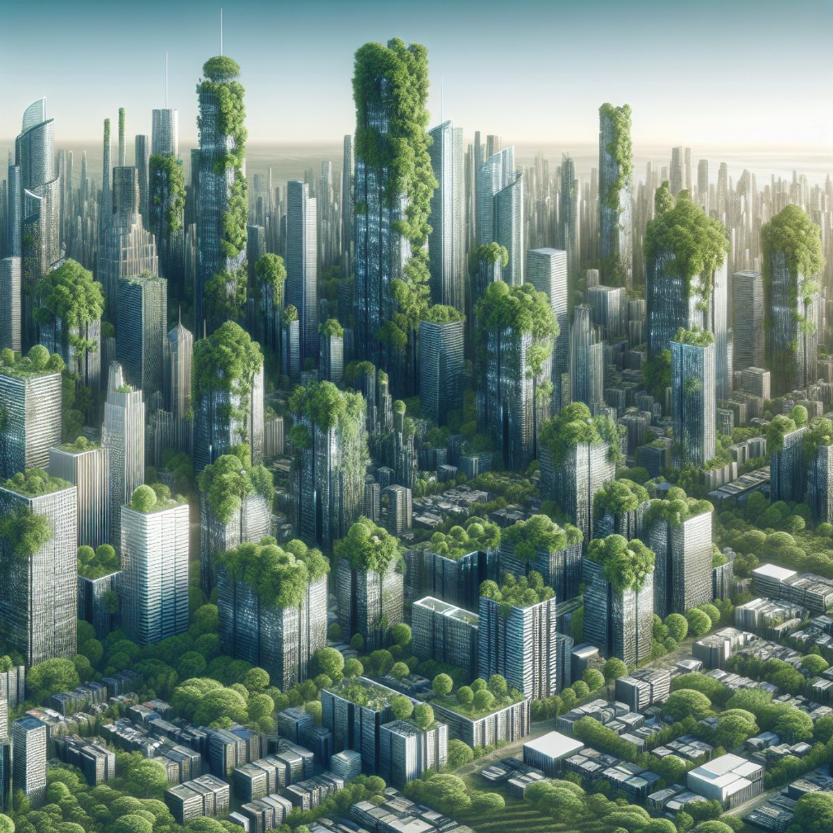
Python has revolutionized the field of urban tree canopy analysis by providing researchers and urban planners with powerful tools for data processing, analysis, and visualization. Its flexibility and versatility make it an ideal programming language for:
- Handling large datasets
- Performing complex calculations
- Visualizing results effectively
The Significance of Trees in Our Cities
Remember: The trees in our cities are not just beautiful; they play a crucial role in mitigating climate change, improving air quality, reducing energy consumption, and enhancing overall well-being. Let's leverage Python to understand and protect our urban tree canopy.
"The best time to plant a tree was 20 years ago. The second best time is now." - Chinese Proverb
FAQs (Frequently Asked Questions)
What is the importance of assessing tree cover on buildings in urban environments?
Assessing tree cover on buildings is crucial for understanding the impact of urbanization on the environment. It helps in evaluating the overall health of urban ecosystems, identifying areas with inadequate green spaces, and developing strategies for sustainable urban development.
How can Python facilitate data analysis for urban tree canopy studies?
Python plays a vital role in urban tree canopy studies by providing powerful tools for data collection, processing, and analysis. Its versatility allows researchers to develop comprehensive tree cover scores, calculate NDVI values from satellite images, analyze tree cover at the building level, and validate analysis results against ground truth data.
What are the key data requirements for conducting an effective analysis of urban tree canopy?
Key data requirements for conducting an effective analysis of urban tree canopy include high-resolution aerial imagery, vector data, and multi-spectral imagery. These datasets are essential for accurately quantifying tree cover and assessing its spatial distribution in urban environments.
How can multi-spectral imagery provide valuable insights for urban tree canopy studies?
Multi-spectral imagery provides valuable insights for urban tree canopy studies by capturing information across different wavelengths of the electromagnetic spectrum. This enables researchers to identify and analyze various vegetation characteristics, including tree cover density and health, which are essential for comprehensive urban tree canopy analysis.
What are the challenges associated with conducting building-level analysis in urban environments?
Challenges associated with conducting building-level analysis in urban environments include variations in building sizes and structures, as well as the need to integrate location, land use data, and building characteristics into the analysis. Overcoming these challenges is essential for accurately assessing tree cover at the building level.
How can researchers ensure spatial accuracy in building footprints for precise tree cover assessment?
Researchers can ensure spatial accuracy in building footprints by leveraging Python to improve the accuracy of building footprints through advanced spatial validation techniques. This ensures precise assessment of tree cover at the building level and enhances the reliability of analysis results.


Comments
Post a Comment